
Information about the 2022 Seeds Trek
Dates
The 2022 Trek group departs on April 30th and return on the 8th May. We start hiking on the 1st May and finish on May 7th. Our trip includes seven days on the trail with one night either side for travel.
Route & Itinerary
The Buller Huts Trail is an opportunity to independently experience the best of the Victorian Alps. Offering breathtaking scenery and a true sense of remoteness, the Buller Huts Trail commences on Mount Buller, high in the Victorian Alps and traverses some of Victoria’s most spectacular mountain summits and historic high country huts. You can read more about our route here: https://www.bullerhutstrail.com.au/portfolio-items/itinerary/
Live Tracking
We have setup a map where you can track our trip. The tracking device is a Garmin InReach Mini and it sends updates every 10 minutes to a detailed map. It will be turned on each morning and turned off once we reach our evening camp. You can acccess the map (mobile or desktop) from: https://share.garmin.com/share/seedstrek2022 using the password: “pwd123“.
Google Map
This map shows each of the days of the walk in different colours. GoogleMap
3D Fly-throughs & Elevation Graphs
We’ve used FatMap to provide some different views of our route. The following links can show 3d fly-through and elevation views and you’ll get a different perspective that offers more understanding of where we are. You’ll need reasonably fast internet for these views. Click on the images to see the data.
Day 1; 17.1km distance, 505m ascent, 1533m descent. ![]()

Day 2; 12.6km distance, 1406m ascent, 473m descent. ![]()
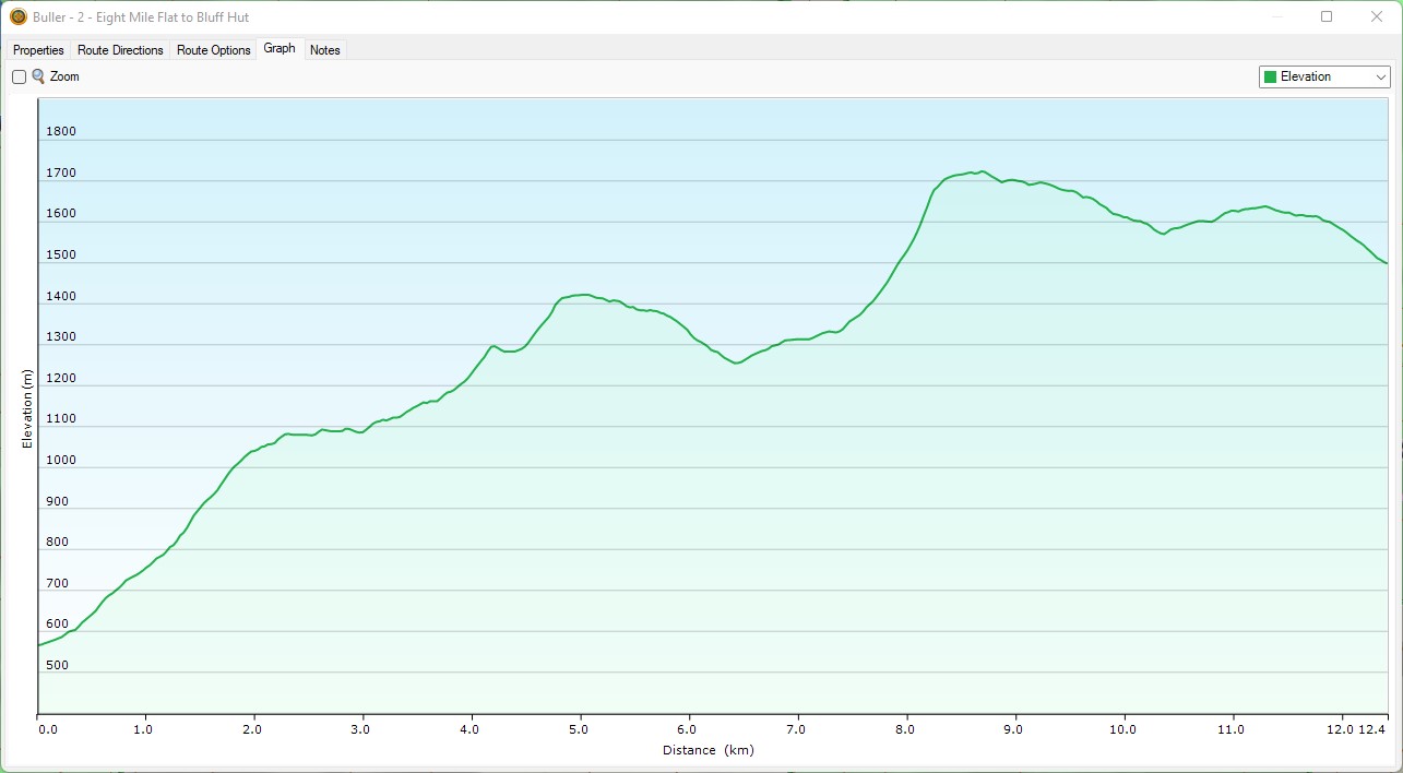
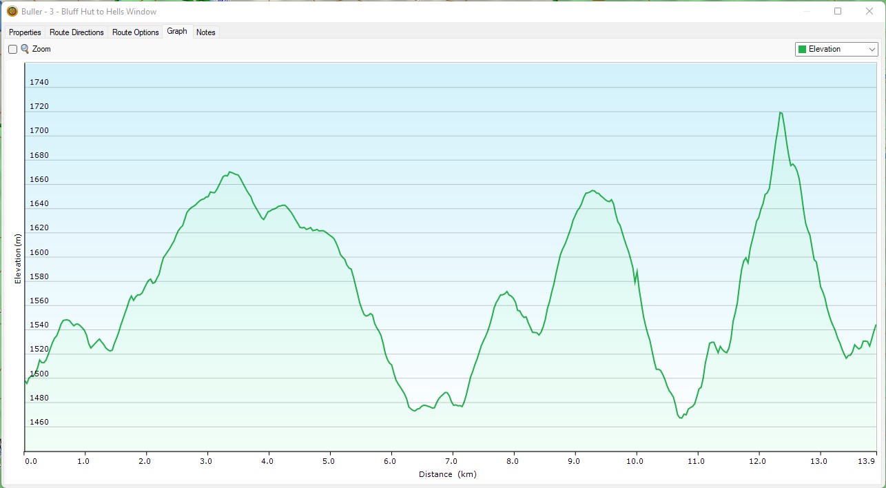
Day 3; 13.4km distance, 691m ascent, 664m descent. ![]()
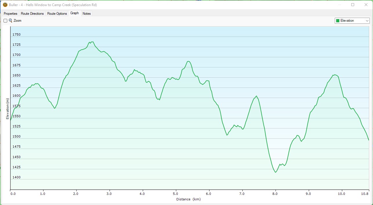
Day 4; 13.6km distance, 906m ascent, 935m descent. ![]()
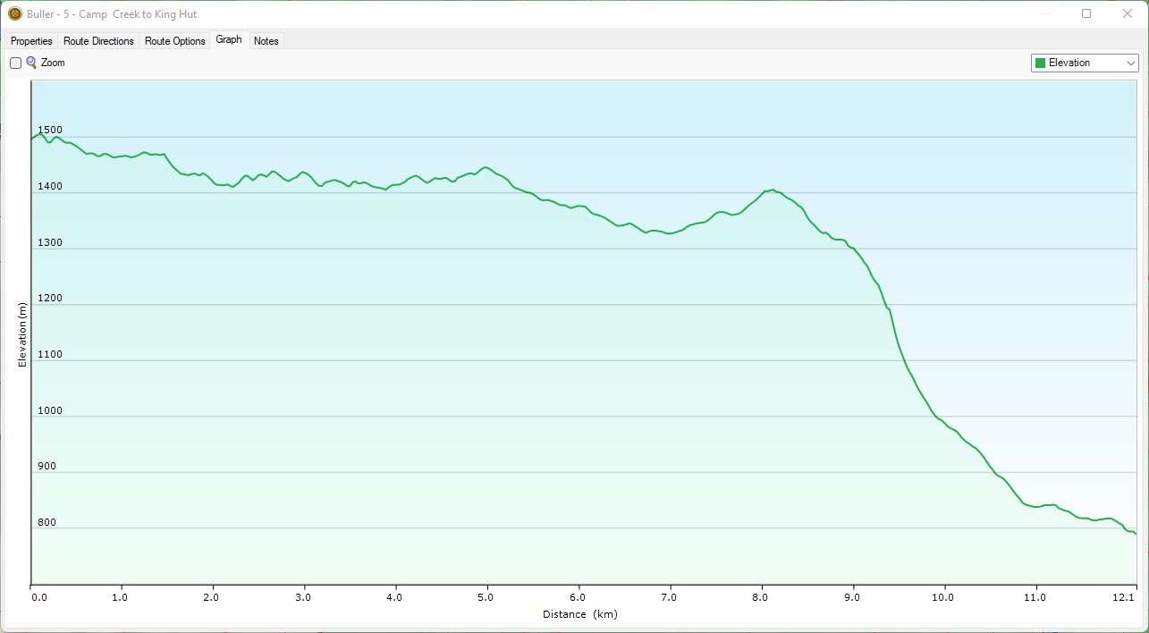
Day 5; 12.1km distance, 221m ascent, 933m descent. ![]()
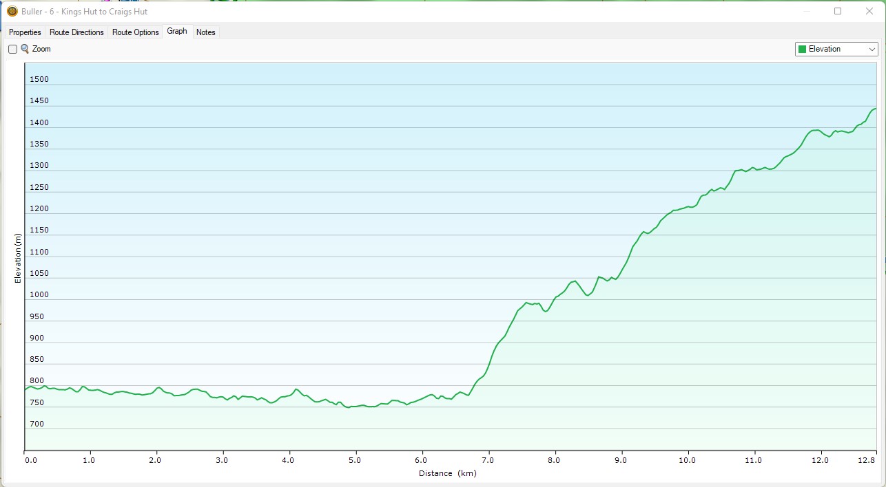
Day 6; 13.2km distance, 925m ascent, 272m descent. ![]()
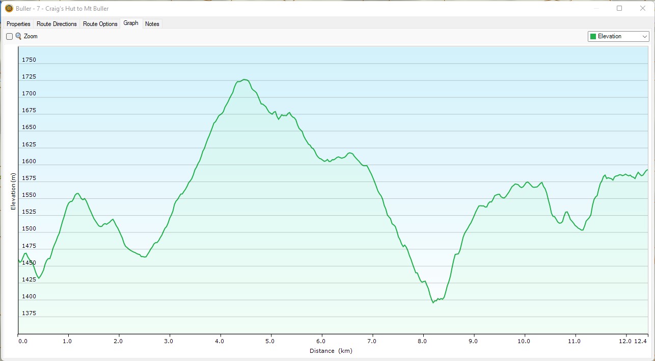
Day 7; 13.2km distance, 743m ascent, 599m descent. ![]()
Complete 7 days flythrough; 95.5km distance, 5068m ascent, 5068m descent.
Weather
We expect the weather to be somewhat unpredictable, however here are some links that have opinions about what might happen:
- BOM – 7 day forecast
- Weather2 – 14 day forecast
- YR – 9 day forecast
- Windy – limited forecast
- Snow Online – 9 day forecast
Actual observations (historical) can be viewed here: