
Information about the 2024 Seeds Trek
Route & Itinerary
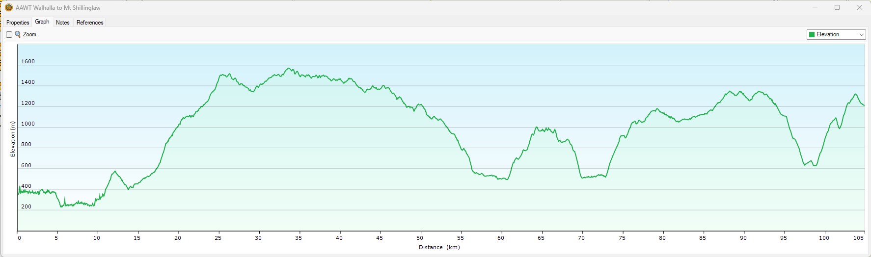
The 2024 Trek aims to cover the start of the AAWT (Australian Alpine Walking Trail). It promises to be an interesting and event filled walk starting at Walhalla, trekking through the Baw Baw National Park, walking next to gold fields and finishing near Mt Shillinglaw. The trek is approximately 110km long and is expected to include over 6000m ascending and 5000m descending. Over five days this promises to be a long and challenging walk.
A link to the proposed route can be viewed here. Here is a link to a file with the GPX routes in it
A distance vs elevation graph for the whole week is shown below. Further day specific maps are shown at the bottom of the page.
Expectations
There is a level of commitment that is required to meet and demonstrate fitness and preparation prior to the hike in order to be successful on the hike. Details will be discussed in the meetings.
Dates
The 2024 Trek dates are Monday 15th April to Sunday 21st April 2024.
1st September 2023 – Last day to join the 2024 team7th September 2023 – Team meeting23rd September 2023 – Group training hike7th November 2023 – Team meeting25th November 2023 – Group training hike23rd January 2024 – Team meeting9th/10th February 2024 – Overnight camp- 2nd March 2024 – Group training hike
- 26th March 2024 – Team meeting
- 15th to 24th April 2024 – Seeds Trek 2024!
Daily elevation charts
Please note two things: firstly, the final route has been decided; secondly, each image shows the scale differently to the other images (the numbers are accurate, the scale is not); thirdly, day one ascent is being viewed as inconclusive as the first 8km has only been measured deep within a valley so others parties tracking data is possibly erroneous due to GPS inaccuracy in that area.
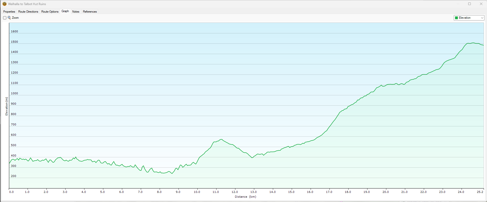
Day 1 – Walhalla to Talbot Hut Ruins
25.1km 1450m (maybe up to 2242m) ascent 1095m descent
Day 2 – Talbot Hut Ruins to Stronarchs Campsite
22.6km 760m ascent 1044m descent

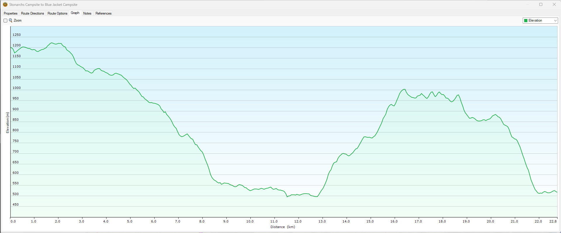
Day 3 – Stronarchs Campsite to Blue Jacket
22.7km 867m ascent 1555m descent
Day 4 – Blue Jacket to Fiddlers Green
14.2km 1014m ascent 382m descent

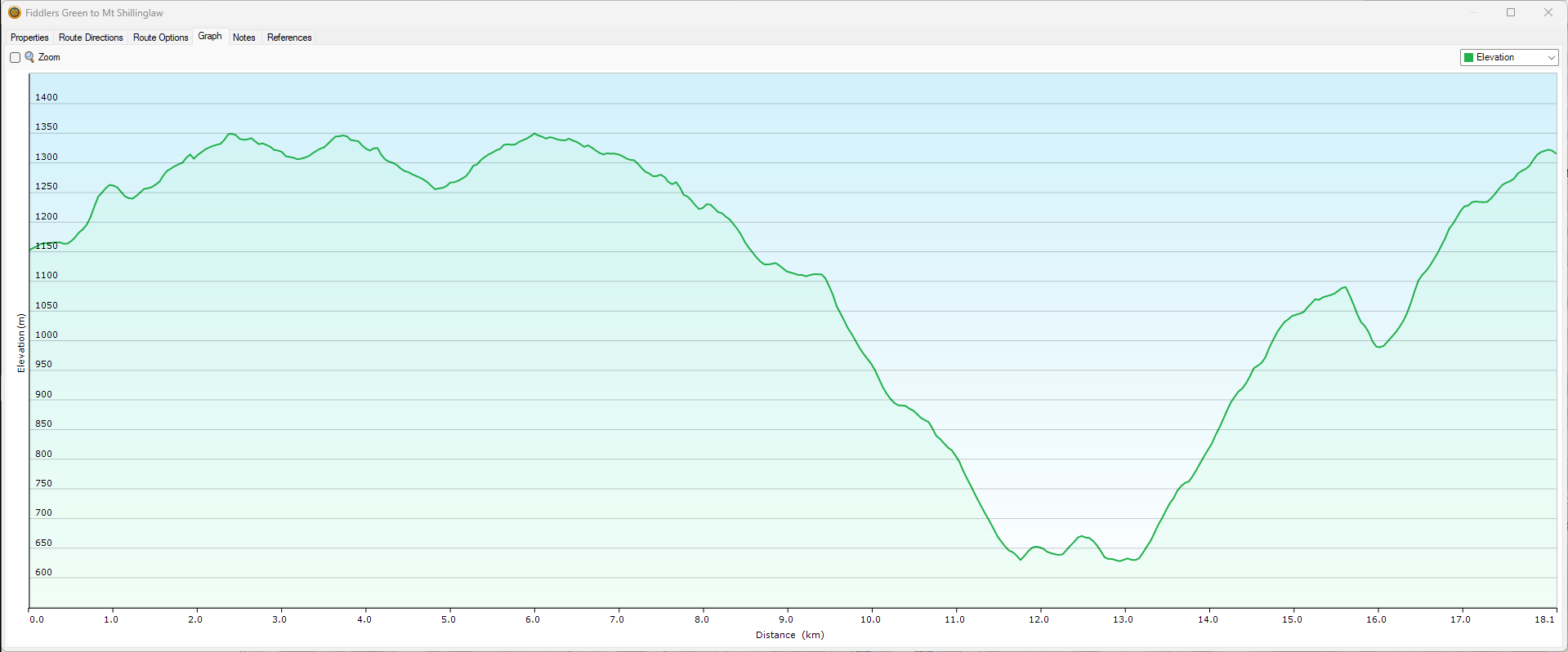
Day 5 – Fiddlers Green to Mt Shillinglaw
18.1km 1244m ascent 1078m descent
Some Videos of FatMap Fly Throughs
(click to watch on YouTube then watch Full Screen)
Fly Throughs
For this to work you need have an account with FatMap, which is free and well worth it.